Innovative 1-Day Map & Compass Training
"I Understood It. Excellent Explanations, Well Paced, Good Use of Hands–on Mixed in with the Lecture" — NCS Participant


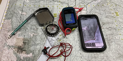
Navigation Core Seminar (NCS) integrates Topographical Maps, Compass, GPS Receivers and Cell Phones in an innovative 1-Day Wilderness Navigation Seminar. This hands-on Wilderness Navigation course provides the knowledge needed for anyone Hiking, Backpacking, Snowshoeing, Cross-Country Skiing, Mountain Biking, Quading, Sledding or Paddling who wishes to travel into the wilderness with an added degree of confidence and safety. This course cover using Cellular Phones and Phone Map Apps in the wilderness.
"…it touched on all areas, i.e. GPS, Compass, and Maps." — NCS Participant
Professional Wilderness Navigation Course
"I think Anyone who Purchases a GPS or wants to Travel in the Outdoors Should Take the Course" — NCS Participant
If you want to learn to use Map & Compass or GPS in the Wilderness properly, improve your knowledge and confidence with a GPS Receiver or gain additional Wilderness Navigation skills then the Navigation Core Seminar is for you. GPS Receivers are excellent tools for navigation when used alongside Topographical Maps & Compass. A Cell phone is a great tool when used alongside other navigation tools.
"I liked the approach — friendly, knowledgeable, moved ahead but not to quickly." — NCS Participant
Navigation Core Seminar Sections & Main Teaching Points
Topographical Map Reading
Learning to Understand Your Map
- Basic Points About Maps
- Topographical Maps
- Map Margin Information
- Map Features
- Measuring Distance
- Understanding Contour & Slope
- Latitude & Longitude
- Grid Reference System (UTM & MGRS)
- Alberta Township Survey (ATS)
Compass Navigation
Intro to Compass Use
- Basic Compass Use
- Intro to Declination
- Using a Compass on the Map
- Using a Compass in the Field
- Compass use on a Phone
Wilderness Navigation
Using your ‘Navigators Toolbelt’
- Wilderness Navigation Hints
- Map Care & Types
- Routes Preparation
- Route Cards
- What to do if Lost?
GPS Introduction
A Tool in your ‘Navigators Toolbelt’
- The Global Positioning System
- How GPS Works?
- GPS Fixes
- GPS Signal Processing
- GPS Accuracy
- WAAS (Wide Area Augmentation System)
- Handheld GPS Receivers
GPS Programming
Garbage-In Garbage-Out
- GPS Menu Systems
- Setting Map Datum
- Setting Position or Coordinate System
- Setting Units or Measure
- Setting Headings
- Setting Time
GPS Position Finding
Using your GPS Receiver
- Waypoints or Landmarks
- Marking Waypoints
- Acquiring your Position
GPS Navigation
Don’t Follow the Magic Box
- GPS Navigation
- Travelling with a GPS
- GPS Tracking
- GPS & Computer Interface
- Cell Phones in the Wilderness
Operating a GPS
Making your GPS Receiver Work
- Battery Life
- Cold Weather Operation
- Wet Weather Operation
- Hints & Reminders
- Buying a Handheld GPS Receiver
Conclusion
Carry your ‘Navigators Toolbelt’
- Tools in Your Toolbelt
- Bruce’s Secret Rules of Navigation
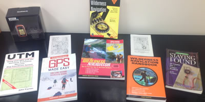
- Further Reading
- Earning your Navigation Certificate
- Web Resources
"I liked the hands–on and the time for questions." — NCS Participant


"I enjoyed the whole course; very interesting & loaded with information." — NCS Participant
It's Time to take Navigation Training
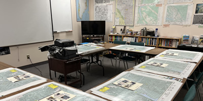
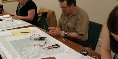
- Highlighted with Demonstrations, Hands-on Practice Exercises and Time for Questions
- We Provide a GPS Receiver, Topographical Maps, and a Compass for your use during this Seminar
- Seminar Manual with a reading List is Provided
- Will provide the Knowledge and Confidence you need to take the Next Step
"Very informative. Good practical sessions outdoors and with Maps." — NCS Participant

